I'd seen photos of Cachoeira da Fumaça for years before I finally stood at the top of it, and none of them prepared me for the wind. You expect a waterfall. You don't expect to watch the water lose the argument with gravity halfway down and just... drift off sideways, like smoke from a chimney. That's the whole point of this place, and it's the reason it's the one waterfall in Chapada Diamantina that everyone tells you not to skip. Where This Waterfall Actually Is Cachoeira da Fumaça sits inside Chapada Diamantina National Park in the state of Bahia, in Brazil's northeast. Most people reach it from Vale do Capão, a small, dusty, slightly hippie town that's become the main base for hikers heading into this part of the park. The falls themselves are technically on the border of the municipalities of Palmeiras and Ibicoara, though nobody local really talks about it that way — it's just "a Fumaça," the falls. The name means Smoke Falls, and it isn't a marketing name. The water drops from a ledge and, because the fall is so long and so exposed, the wind catches it well before it reaches the canyon floor. On a breezy day the whole thing dissolves into a fine mist that sways back and forth like it's alive. Locals sometimes call it Véu de Noiva too — Bride's Veil — for the same reason. The Height Depends on Who You Ask Wikipedia lists it at 340 metres. That's the figure that used to make it Brazil's tallest waterfall, before a taller one turned up in the Amazon and took the title. Ask a guide in Vale do Capão, though, and you'll probably hear something closer to 360 or 380. I've seen 420 written on a couple of travel blogs, which felt like a stretch. Nobody local seemed bothered by the discrepancy, and after a while, neither was I. It's tall enough that the water arrives as rain, not a stream, and that's really the only number that matters once you're standing there. It's still generally counted as the second-highest free-falling waterfall in the country. From the top, I had no reason to doubt it. The Hike Up You can see Fumaça from above, at the canyon rim, or from below, camping near the base and looking up. I did the top route, mainly because it doesn't require hauling a tent, and it's the one most people manage in a single long day from Vale do Capão. The trail runs about 12 km there and back. The first stretch is a proper climb, maybe two kilometres of it, and it's the kind of uphill that has you stopping to "check the view" every few minutes when really you just need to breathe. After that it eases into a long, flat walk across open plateau — low scrub, strange rock outcrops, not much shade — until the trail simply runs out at the edge of a canyon and the falls are below you. A guide isn't always required, depending on which trailhead and association you go through, but I'd hire one regardless. There's very little signage once you're past the scrubland, and a guide will time your arrival for when the wind is actually pushing the mist around, rather than when the water's just falling straight down and doing nothing interesting. The Rest of That Trip Fumaça ended up being one stop on a longer loop through Bahia and Minas Gerais. Before it, I'd spent a few days around Serra do Cipó National Park, a couple of hours outside Belo Horizonte — different state, different landscape entirely, all canyons and quartzite cliffs and grassland. The Cachoeira da Farofa hike out there is its own full day, and lunch afterwards was a wood-fired, pay-by-weight spread that I still think about. Moving between towns took some patience. The leg I remember most was an overnight bus to Feira de Santana, getting in early, then catching a connecting bus onward to Itacaré on the coast. Nothing about it was comfortable, but it worked, and it was cheap. A Few Practical Things Sun protection matters more than you'd think — there's almost no shade once you clear the initial climb, and the plateau reflects heat back at you. Bring bug spray too, and shoes you don't mind getting wet, since there's a stream crossing partway along. If your phone matters to you, put it in something waterproof; the mist near the viewpoint travels further than it looks like it should. And skip anything with a smooth sole. The rock right at the edge, where everyone wants their photo, gets slick, and that's not a spot to be sliding around in. Was It Worth It Yes. Somewhere near the top, the trees thin out and the whole canyon opens up in front of you, with this pale strip of water swaying in the middle of it, never quite reaching the ground. Photos of it exist everywhere online, mine included now, and none of them really get across what it's like watching it move in real wind. If it's on your list for Chapada Diamantina, give it the whole day. You'll want it.
Cachoeira da Fumaça

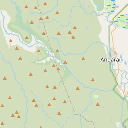


Waterfall height
Plan your visit to Cachoeira da Fumaça
Please verify on the official website before you go
Why is Cachoeira da Fumaça famous?
Cachoeira da Fumaça is one of Brazil's tallest waterfalls at 340 meters, famous for the phenomenon where its water often evaporates into mist before reaching the bottom, especially in dry season, creating a 'smoke' effect that gives it its name. The dramatic cliff-top viewpoint offers breathtaking views across the Chapada Diamantina highlands.
Can you swim at Cachoeira da Fumaça?
No. The waterfall is viewed from the top of a 340-meter cliff; no swimming area at the viewpoint. Please verify on the official website before you go.
Are dogs allowed at Cachoeira da Fumaça?
Dogs are generally allowed on-leash in Chapada Diamantina National Park trails, but confirm current rules. Please verify on the official website before you go.
Is Cachoeira da Fumaça free? Do you need a permit?
Chapada Diamantina National Park entry is free, but a local guide is strongly recommended and may be required; guide fees vary. Please verify on the official website before you go.
Is there parking at Cachoeira da Fumaça?
Parking is available at the trailhead near Vale do Capão village; typically free but limited capacity. The trail begins from this parking area. Please verify on the official website before you go.
How long is the hike to Cachoeira da Fumaça?
Approximately 12 km (7.5 miles) return from the trailhead to the top viewpoint of the waterfall. Please verify on the official website before you go.
Cachoeira da Fumaça hike difficulty
Hard. The 6 km one-way trail involves significant elevation gain, rocky terrain, river crossings, and exposed sections requiring good fitness and navigation. Please verify on the official website before you go.
When is the best time to visit Cachoeira da Fumaça?
May to September (dry season) for safer trail conditions and clearer views from the top, though water flow is reduced. December to March brings heavier flow but muddy, slippery trails. Please verify on the official website before you go.
Route and trail notes for Cachoeira da Fumaça
The trail starts from Vale do Capão and follows a rocky, sometimes steep path through cerrado and cloud forest. You will cross streams and navigate rocky sections before reaching the cliff-top viewpoint overlooking the 340-meter drop. The waterfall often appears as mist (fumaça means smoke) due to the height. Return via the same route.
Cachoeira da Fumaça official website
Attractions near Cachoeira da Fumaça
- •Vale do Capão – scenic valley village serving as a base for the hike, 6 km from trailhead
- •Cachoeira do Riachinho – smaller waterfall accessible on the same trail route
- •Morro do Pai Inácio – iconic flat-topped mountain viewpoint with sunset views, ~60 km away
- •Poço Azul and Poço Encantado – stunning blue cave pools for snorkeling, ~100 km south
Safety information
Waterfalls can be unforgiving. Read these before you go — and please, use your judgement on the day.
Full safety guide →Questions & answers
No questions yet — be the first to ask.