There are no gas stations along the parkway, so if needed, you can detour to small towns near the route to refuel and take a break before continuing your journey. Every part of the Blue Ridge Parkway is beautiful. Of course, the iconic Mabry Mill and Crabtree Falls are also places you definitely shouldn't miss.
Crabtree Falls (VA)
1 photo

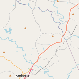


Leaflet © OpenStreetMap
366m
Waterfall height
Plan your visit to Crabtree Falls (VA)
Please verify on the official website before you go
Why is Crabtree Falls (VA) famous?
Crabtree Falls is one of the tallest waterfall systems east of the Mississippi River, cascading over 1,200 feet in five major tiers. It is also known for being one of the most dangerous waterfall sites in Virginia, with over 30 recorded deaths from falls and drownings, leading to strict safety warnings.
Can you swim at Crabtree Falls (VA)?
No — swimming and wading are prohibited due to dangerous conditions and numerous fatalities. Please verify on the official website before you go.
Are dogs allowed at Crabtree Falls (VA)?
Dogs allowed on-leash on the trail. Please verify on the official website before you go.
Is Crabtree Falls (VA) free? Do you need a permit?
Free — no entrance fee or permit required for day use. Please verify on the official website before you go.
Is there parking at Crabtree Falls (VA)?
A designated parking area is located at the trailhead with approximately 75 spaces. Parking is free but can fill quickly on weekends and peak seasons. Please verify on the official website before you go.
How long is the hike to Crabtree Falls (VA)?
About 4.8 km / 3 miles return (2.4 km / 1.5 miles one-way) to the upper falls on a steep, rocky trail. Please verify on the official website before you go.
Crabtree Falls (VA) hike difficulty
Moderate to Hard — steep climb with switchbacks, rocky terrain, and significant elevation gain (approximately 500 feet). Please verify on the official website before you go.
When is the best time to visit Crabtree Falls (VA)?
Spring (April–May) for peak water flow from snowmelt and rainfall, or autumn (October–November) for fall foliage. Summer can have lower flow. Please verify on the official website before you go.
Route and trail notes for Crabtree Falls (VA)
From the parking area, the trail begins at the lower end and climbs steeply via a series of switchbacks alongside the cascading falls. Multiple overlook platforms provide views of different sections of the waterfall. The trail is rocky and can be slippery when wet. Stay on marked trails and behind guardrails — venturing off-trail or attempting to climb on rocks near the falls is extremely dangerous.
Crabtree Falls (VA) official website
Attractions near Crabtree Falls (VA)
- •Blue Ridge Parkway — scenic mountain drive with overlooks and trails (access nearby)
- •Wintergreen Resort — year-round mountain resort with skiing, golf, and hiking
- •Sherando Lake Recreation Area — swimming beach, camping, and trails about 30 min north
- •Montebello — small mountain town near the trailhead with local services
Safety information
Waterfalls can be unforgiving. Read these before you go — and please, use your judgement on the day.
Full safety guide →Questions & answers
No questions yet — be the first to ask.