Exploring the Highlands waterfall source along the A894 road, discovering a wild hidden landscape This spot is called Allt Chranaidh. It is not the tallest waterfall in the UK, but it sits in a remote area along the A894, where there is a small informal parking area by the roadside. From there, it takes less than 20 minutes to walk to the water source. However, there is no proper trail. The ground is muddy with boggy sections, and the cliff edges are often covered by vegetation, making it hard to judge where the drop-offs are. There is a real risk of slipping or stepping too close to unstable ground, so caution is essential. For reference, the tallest waterfall in the UK is Eas a’ Chual Aluinn, with a 200-meter drop. Reaching it requires a hike of around 3 to 4 hours.
Eas a' Chual Aluinn


Waterfall height
Plan your visit to Eas a' Chual Aluinn
Please verify on the official website before you go
Why is Eas a' Chual Aluinn famous?
Eas a' Chual Aluinn is Britain's highest waterfall at approximately 200 metres (658 feet), making it nearly three times the height of Niagara Falls. Despite its record height, it remains one of the most remote and least-visited major waterfalls in the UK due to its inaccessible location in the Scottish Highlands.
Can you swim at Eas a' Chual Aluinn?
No — the waterfall is remote and located at the base of a steep cliff with no safe swimming access. Please verify on the official website before you go.
Are dogs allowed at Eas a' Chual Aluinn?
Dogs allowed on-leash on the hiking trails in the area. Please verify on the official website before you go.
Is Eas a' Chual Aluinn free? Do you need a permit?
Free — no entry fee or permit required to access this remote waterfall on open hillside. Please verify on the official website before you go.
Is there parking at Eas a' Chual Aluinn?
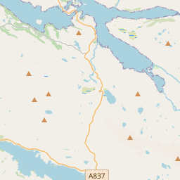
Limited informal parking at the trailhead near Loch Beag, accessed via a single-track road south of Kylesku. Parking is free but very limited (space for only a few vehicles). Please verify on the official website before you go.
How long is the hike to Eas a' Chual Aluinn?
About 7–8 km (4.3–5 miles) return from the parking area near Loch Beag, though some sources cite up to 10 km depending on exact route. Please verify on the official website before you go.
Eas a' Chual Aluinn hike difficulty
Hard — remote, pathless terrain over rough, boggy ground with significant navigation skills required. No marked trail for most of the route. Please verify on the official website before you go.
When is the best time to visit Eas a' Chual Aluinn?
Late spring to early autumn (May–September) for best weather and access, though flow is strongest after heavy rain in autumn/winter. The remote location can be impassable in winter. Please verify on the official website before you go.
Route and trail notes for Eas a' Chual Aluinn
From the parking area near Loch Beag, head east across pathless, rough terrain following the Allt a' Chual Aluinn burn. Navigation is challenging with no marked path; a map and compass (or GPS) are essential. The waterfall is best viewed from the top of the cliffs, though approaching the base requires very steep and difficult descent. Most hikers view from the clifftop overlook.
Attractions near Eas a' Chual Aluinn
- •Kylesku Bridge — dramatic curved bridge over Loch a' Chàirn Bhàin with viewpoints
- •Quinag — distinctive mountain with multiple peaks offering challenging hillwalking
- •Loch Glencoul — deep sea loch accessible by boat tour from Kylesku
- •Ardvreck Castle — 16th-century ruined castle on the shores of Loch Assynt
- •Bone Caves — archaeological caves near Inchnadamph with Ice Age animal remains
Safety information
Waterfalls can be unforgiving. Read these before you go — and please, use your judgement on the day.
Full safety guide →Questions & answers
No questions yet — be the first to ask.
More to explore nearby
Falls of Foyers
Loch Ness, Scotland
Two-tiered waterfall above Loch Ness.
Sligachan Falls
Isle of Skye, Scotland
Cuillin mountain backdrop with magical river pools.
Steall Falls
Glen Nevis, Scotland
Scotland's second-tallest waterfall near Ben Nevis.
Plodda Falls
Glen Affric, Scotland
Iron viewing bridge above a Caledonian Forest plunge.