Glymur Waterfall is Iceland’s tallest accessible waterfall at 198 metres, tucked deep inside a dramatic canyon. Reaching it requires a 6.6 km return hike with about 450 metres of elevation gain, taking roughly 4 hours. It’s widely considered one of the best day hikes along Iceland’s Ring Road—scenic, quiet, and rewarding. Getting there: We left Reykjavík at 8 a.m. and arrived at the trailhead in about an hour. The parking lot had only three cars—completely peaceful. The first half hour of the trail is relatively easy and gentle, until the canyon suddenly opens up, the sound of rushing water grows louder, and the path becomes much steeper. Birds glide along the cliff edges in the wind, giving the whole atmosphere a strong Lord of the Rings feel. Eventually, Glymur appears—especially spectacular after rain. Water plunges from the cliff edge straight into a dark gorge below, crashing down with incredible force and echoing through the canyon.
Glymur




Waterfall height
Plan your visit to Glymur
Please verify on the official website before you go
Why is Glymur famous?
Glymur was long considered Iceland's tallest waterfall at 198 meters until Morsárfoss was measured higher in 2011. It remains one of Iceland's most spectacular and rewarding hikes, plunging dramatically into a narrow canyon in the beautiful Hvalfjörður fjord area.
Can you swim at Glymur?
No. Glymur is a very tall waterfall in a narrow canyon with strong currents and cold water; swimming is not safe or permitted. Please verify on the official website before you go.
Are dogs allowed at Glymur?
Dogs are generally allowed on-leash on Icelandic hiking trails, but confirm current rules for this area. Please verify on the official website before you go.
Is Glymur free? Do you need a permit?
Free. No entry fee or permit is required to hike to Glymur. Please verify on the official website before you go.
Is there parking at Glymur?
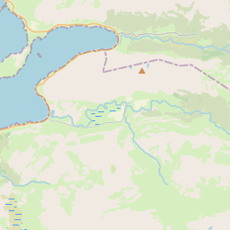
Free parking is available at the trailhead near Botnsá river at the end of Road 47 (turn off Ring Road 1). Space is limited, so arrive early in peak season. Please verify on the official website before you go.
How long is the hike to Glymur?
About 7–8 km (4.3–5 mi) return from the parking area, taking approximately 3–4 hours total. Please verify on the official website before you go.
Glymur hike difficulty
Hard. The trail includes steep sections, a river crossing via log and cable (which can be challenging or impossible when water is high), rocky terrain, and significant elevation gain. Please verify on the official website before you go.
When is the best time to visit Glymur?
Late spring to early autumn (May–September) offers the best weather and safest trail conditions, with the river crossing more manageable. Winter and early spring can be dangerous due to ice and high water. Please verify on the official website before you go.
Route and trail notes for Glymur
From the parking area, cross the Botnsá river via a log with a steel cable (can be impassable in high water). Follow the trail up the west side of the canyon with views of the falls. The path climbs steeply with some exposed sections. You can loop back on the east side or return the same way. Note: the river crossing is the most challenging part and conditions vary.
Attractions near Glymur
- •Hvalfjörður fjord — scenic fjord with WWII history and whale watching opportunities
- •Þingvellir National Park — UNESCO site and part of the Golden Circle, about 50 km away
- •Esja mountain — popular hiking mountain visible from Reykjavík, nearby
- •Borgarnes — historic town with Settlement Center museum, about 40 km north
Safety information
Waterfalls can be unforgiving. Read these before you go — and please, use your judgement on the day.
Full safety guide →Questions & answers
Loading questions…