**“Hat Mountain” in the mist** In Iceland, the so-called “Hat Mountain” usually refers to Kirkjufell, also known in Chinese as “Straw Hat Mountain.” It is one of the most iconic peaks on the Snæfellsnes Peninsula in western Iceland. This mountain is a glacially carved volcanic formation, shaped over time from ancient lava flows and ice erosion. It is not an active volcano. The mountain has a near-perfect cone shape, with clearly layered black basalt. From a distance, it looks like an upside-down straw hat or even a church steeple—hence the name “Church Mountain.” At its base lies Kirkjufellsfoss Waterfall. The combination of the multi-tiered waterfall and the mountain backdrop creates one of Iceland’s most famous and photographed viewpoints.
Kirkjufellsfoss


Waterfall height
Plan your visit to Kirkjufellsfoss
Please verify on the official website before you go
Why is Kirkjufellsfoss famous?
Kirkjufellsfoss became internationally famous as a filming location for Game of Thrones (the 'arrowhead mountain' north of the Wall in Season 7). The waterfall with Kirkjufell mountain behind it is one of Iceland's most photographed landscapes and an iconic image of the Snæfellsnes Peninsula.
Can you swim at Kirkjufellsfoss?
No. The waterfall is shallow and rocky, primarily a viewing and photography site, not suitable for swimming. Please verify on the official website before you go.
Are dogs allowed at Kirkjufellsfoss?
Dogs allowed on-leash on public trails and areas in Iceland generally. Please verify on the official website before you go.
Is Kirkjufellsfoss free? Do you need a permit?
Free. No entry fee or permit required to visit Kirkjufellsfoss or the surrounding area. Please verify on the official website before you go.
Is there parking at Kirkjufellsfoss?
Free parking area directly adjacent to Kirkjufellsfoss with space for multiple vehicles, right off Route 54. The waterfall is visible from the car park. Please verify on the official website before you go.
How long is the hike to Kirkjufellsfoss?
Roadside attraction with no hike required. A short 50-100 meter walk on flat ground from the car park to viewing platforms and closer vantage points. Please verify on the official website before you go.
Kirkjufellsfoss hike difficulty
Roadside (no hike). The waterfall is immediately accessible from the parking area on flat, well-trodden paths suitable for all fitness levels. Please verify on the official website before you go.
When is the best time to visit Kirkjufellsfoss?
May to September for accessible roads, long daylight hours, and milder weather, though the waterfall flows year-round. Winter offers Northern Lights opportunities but icy conditions. Please verify on the official website before you go.
Route and trail notes for Kirkjufellsfoss
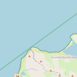
From the parking area off Route 54, walk toward the waterfall on a short, flat path. Multiple viewing angles are available from boardwalks and rocks along the stream. The classic photography composition includes Kirkjufell mountain in the background, best captured from the near-stream level positions.
Attractions near Kirkjufellsfoss
- •Kirkjufell mountain — iconic cone-shaped peak directly behind the waterfall, one of Iceland's most photographed mountain
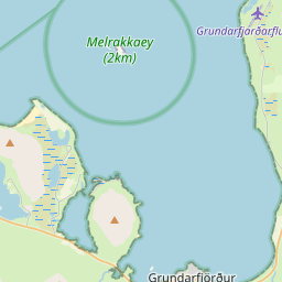
- •Grundarfjörður town — charming fishing village 5 km away with restaurants, accommodation, and services
- •Saxhóll crater — volcanic crater with stairs to the rim offering panoramic views of lava fields
- •Djúpalónssandur beach — dramatic black pebble beach with ship wreckage and lifting stones
- •Snæfellsjökull National Park — glacier-capped volcano and coastal park about 40 km southwest
Safety information
Waterfalls can be unforgiving. Read these before you go — and please, use your judgement on the day.
Full safety guide →Questions & answers
No questions yet — be the first to ask.