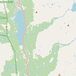
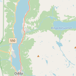
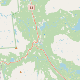
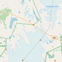
There's a stretch of road in western Norway where you can't really drive past without stopping, even if you only meant to glance at it on the way to somewhere else. That's Låtefossen. It sits right beside National Road 13 in the Odda Valley, often nicknamed Norway's "Valley of Waterfalls," and it has a habit of turning a quick drive-by into a twenty-minute detour. What Makes This Waterfall Different Most waterfalls give you one column of water. Låtefossen gives you two. Two separate streams tumble down the mountainside side by side, and by the time they reach the bottom they've merged into a single, thundering rush that passes directly under an old stone arch bridge. The total drop is about 165 metres, and because the falls sit so close to the road, you feel the spray on your face before you've even parked the car. It's one of the most photographed spots in the whole Hardangerfjord region, and once you're standing there, it's obvious why. The bridge, the mist, the two falls meeting in the middle - it's a scene that looks almost staged, except nobody built it. Norway just left it there for people to drive through. Getting There Låtefossen sits on Route 13, between the towns of Odda and Røldal, so it's an easy stop if you're already travelling that road. From Odda, it's about a 15-minute drive south. From Røldal, plan for roughly 30 minutes. Either way, you won't need to go looking for it - the falls are visible from the road, and there's a small parking area right beside them. A Bridge With More History Than You'd Expect The stone bridge at Låtefossen was completed in 1859, back when Norway was pushing a new road link between the east and west of the country over the Haukeli mountains. It was one of the first major construction projects along that route, and for decades afterwards, visitors were brought here by horse and carriage just to see the falls and the valley view from the bridge. The bridge you see today isn't quite the original, though. As cars got bigger through the 20th century, the old six-arched crossing became too narrow, and it was widened in the 1940s to handle modern traffic. There was also a small café near the falls in the early tourism days, though only traces of it remain now. A Few Things Worth Knowing Before You Stop Because the falls sit right on the main road, almost everyone passing through pulls over for a look, which is part of the problem. The parking area is small, and in July and August it fills up fast. If you'd rather not circle looking for a space, aim for spring or autumn, or get there early in the day. The bridge itself narrows the road, and traffic tends to slow right down as drivers stop to take photos from their windows. It's worth keeping an eye on the signage and giving yourself a little extra time here rather than rushing through - this isn't a spot to be checking your mirrors while someone's kids run out for a better angle. The Old Path Above the Falls If you want to see Låtefossen from somewhere other than the road, there's an old route worth knowing about. About 50 to 60 metres south of the bridge, an old track climbs up the eastern side of the valley. It follows what used to be the original road before the modern highway took over, and it leads up to a viewpoint above the falls, close to where an old tourist café once stood. It's a short, steep walk rather than a hike, but it gives you a completely different perspective on the falls - looking down on the water instead of standing beside it. Just be careful near the road edge on your way up, since it runs close to fast-moving traffic. Why It's Worth the Stop Låtefossen isn't hidden, and it isn't hard to reach, which is exactly why so many people end up loving it. You don't need a guide, a permit, or half a day free. You just need to be driving through the Odda Valley and willing to pull over. Stand on that bridge for a minute, feel the spray coming off two waterfalls at once, and it's easy to understand why travellers have been stopping here since the 1800s. Some places earn their reputation the easy way - Låtefossen is one of them.
Låtefossen


Waterfall height
Plan your visit to Låtefossen
Please verify on the official website before you go
Why is Låtefossen famous?
Låtefossen is famous for its dramatic twin cascades that plunge 165 meters down the mountainside and converge at a historic six-arched stone bridge on Route 13, creating one of Norway's most photographed roadside waterfalls. It is a signature stop along the scenic Hardanger route and exemplifies Norway's accessible natural beauty.
Can you swim at Låtefossen?
No — Låtefossen is a powerful twin waterfall cascading directly beside Route 13; swimming is not safe or practical. Please verify on the official website before you go.
Are dogs allowed at Låtefossen?
Dogs are generally allowed on-leash along the roadside viewing area and nearby trails. Please verify on the official website before you go.
Is Låtefossen free? Do you need a permit?
Free — Låtefossen is a roadside attraction along Route 13 with no entry fee or permit required. Please verify on the official website before you go.
Is there parking at Låtefossen?
There is a small free parking area directly beside Route 13 at the base of the waterfall, with space for approximately 10–15 cars. The viewing area is immediately adjacent to the parking (roadside). Please verify on the official website before you go.
How long is the hike to Låtefossen?
Roadside (no hike) — Låtefossen is visible and accessible directly from Route 13 with parking immediately beside the falls. Please verify on the official website before you go.
Låtefossen hike difficulty
Roadside (no hike) — The waterfall is viewed from the road and historic stone bridge; no trail hiking required. Please verify on the official website before you go.
When is the best time to visit Låtefossen?
Late spring to early summer (May–July) for maximum water flow from snowmelt, creating the most dramatic display. Autumn (September–October) also offers good flow and fewer crowds. Please verify on the official website before you go.
Attractions near Låtefossen
- •Trolltunga — iconic cliff ledge hike with stunning fjord views, approx. 50 km north
- •Buarbreen Glacier — accessible glacier arm of Folgefonna, near Odda
- •Hardangerfjord — one of Norway's most scenic fjords, easily explored from Odda
- •Skjervsfossen — another impressive waterfall along Route 13, a few km away
- •Odda town — gateway to Hardanger region with services, accommodations, and cafes
Safety information
Waterfalls can be unforgiving. Read these before you go — and please, use your judgement on the day.
Full safety guide →Questions & answers
No questions yet — be the first to ask.
More to explore nearby
Vøringsfossen
Eidfjord, Vestland
Norway's most-visited waterfall plunging into Mabodalen valley.
Langfoss
Akrafjord, Vestland
One of the world's most beautiful waterfalls per CNN.
Vettisfossen
Årdal, Vestland
Norway's tallest unregulated free-falling waterfall.
Steinsdalsfossen
Norheimsund, Vestland
Walk safely behind Norway's most-visited walk-behind fall.