Ramona Falls, Oregon — What to Know Before You Go Ramona Falls has ended up on the cover of Moon and Lonely Planet Oregon guides more than once — it's a genuinely unique, beautiful waterfall. Which makes it a little strange that there aren't that many trip reports out there for it. So here's mine. The trail itself is easy — it's the getting there that has a couple of quirks. You have to cross the Sandy River at some point, and the road leading in near the trailhead gets rough enough that it's tough for a small car to handle comfortably. The Hike We did it on a weekend, round trip somewhere around 7–8 miles depending on exactly how you count it, and it took us about 3–4 hours. The trail condition itself is decent, and partway through you cross the river on a log bridge — a fun little addition to the hike. Along the way there's a creek with small fish swimming in it, and rocks covered in moss everywhere — it has that deep, immersive forest feel. Add in glimpses of Mt. Hood's snowy peak popping into view as you climb, and it's a great combination for photos. By the time you reach the falls, the cool mist hits you almost instantly — a nice payoff after the walk in. We got to the trailhead around 8am on a Saturday and it wasn't crowded at all — by the time we reached the falls, there was only one other group of hikers there. Ramona Falls sits right at the foot of Mt. Hood, so throughout the climb you keep catching glimpses of its snowy summit peeking through. Mt. Hood, the Sandy River, forest, and a waterfall — hard to beat that combination. It's Longer Than It Looks The trail isn't difficult and doesn't involve much elevation gain, but it really does take a while — plan for around 4 hours for the full loop. Bring enough water, and seriously, wear sunscreen. I didn't put on enough and came home with swollen, sunburned arms. The River Crossing At some point you'll need to cross the river. If water levels are high, that means balancing across a log bridge, which tests your balance more than you'd expect. Otherwise, you can just accept wet shoes and wade through — a lot of people hiking with dogs just do that instead of dealing with the log bridge. Quick Tips Small cars may struggle on the rough road near the trailhead — keep that in mind if that's what you're driving. Round trip is roughly 7–8 miles and takes about 3–4 hours — bring enough water for the full distance. Wear sunscreen. Genuinely, don't skip this one. Expect a river crossing — either the log bridge (balance required, especially when water is high) or wading through in shoes you don't mind getting wet. Go early on weekends if you want it quiet — 8am start meant barely any other hikers.
Ramona Falls



Waterfall height
Plan your visit to Ramona Falls
Please verify on the official website before you go
Why is Ramona Falls famous?
Ramona Falls is famous for its delicate fan-shaped cascade that spreads over a wall of columnar basalt, creating a curtain-like effect. The waterfall is a beloved day hike destination in Mt Hood National Forest, showcasing the region's volcanic geology and old-growth forest ecosystem.
Can you swim at Ramona Falls?
No — Ramona Falls is a cascading waterfall over basalt columns, not a swimming hole. Please verify on the official website before you go.
Are dogs allowed at Ramona Falls?
Dogs allowed on-leash on the Ramona Falls Trail. Please verify on the official website before you go.
Is Ramona Falls free? Do you need a permit?
Northwest Forest Pass required for parking ($5 day use or $30 annual). Wilderness permit may be required for entry into Mt Hood Wilderness — please check the official website. Please verify on the official website before you go.
Is there parking at Ramona Falls?
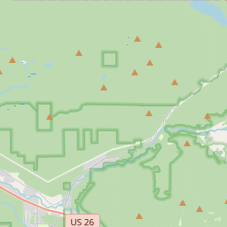
Parking at the Ramona Falls Trailhead; Northwest Forest Pass required ($5 day use or $30 annual). The trailhead is accessed via Road 1825, approximately 6 miles from Highway 26. Please verify on the official website before you go.
How long is the hike to Ramona Falls?
About 11.6 km / 7.2 miles loop (or 10.5 km / 6.5 miles out-and-back) from the trailhead. Please verify on the official website before you go.
Ramona Falls hike difficulty
Moderate — relatively flat terrain but longer distance, includes a Sandy River crossing (can be challenging in high water), well-maintained trail. Please verify on the official website before you go.
When is the best time to visit Ramona Falls?
Late spring through early fall (June–September) for best trail access and waterfall flow; winter snowpack closes the road and trail. Please verify on the official website before you go.
Route and trail notes for Ramona Falls
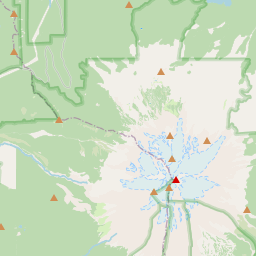
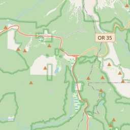
From the trailhead, cross the Sandy River (via bridge or log crossing depending on season and water levels). The trail forms a loop; most hikers take the right fork (Trail 797) going counterclockwise through old-growth forest. At approximately 5.5 km you reach Ramona Falls, which fans over a basalt cliff. Return via the left fork (Timberline Trail 600) to complete the loop, or retrace your steps.
Ramona Falls official website
Attractions near Ramona Falls
- •Timberline Lodge — historic 1930s WPA lodge on Mt Hood's south side with year-round skiing
- •Sandy River — scenic river with multiple crossings along the Ramona Falls loop trail
- •Yocum Ridge — advanced mountaineering route with views of Sandy Glacier
- •Lost Lake — mountain lake with iconic Mt Hood reflection views, camping and paddling
- •Zigzag Ranger Station — permits and trail information for Mt Hood Wilderness
Safety information
Waterfalls can be unforgiving. Read these before you go — and please, use your judgement on the day.
Full safety guide →Questions & answers
No questions yet — be the first to ask.
More to explore nearby
Multnomah Falls
Portland, Oregon
The third stop of our autumn trip around Portland was the main reason for this whole journey — Multnomah Falls.
Salt Creek Falls
Oakridge, Oregon
Oregon's second-tallest single-drop waterfall.
Latourell Falls
Corbett, Oregon
Columbia Gorge fall with vivid yellow lichen.
Wahkeena Falls
Corbett, Oregon
Trailhead neighbour to Multnomah Falls.