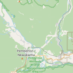
Pemberton • Nairn Falls Our destination for this trip was Pemberton. Driving north from Vancouver, passing Whistler and continuing for another 20 minutes or so, you’ll arrive at the small town of Pemberton. It feels like a more low-key version of Banff—much quieter and more affordable. With half a day to spare, we chose to visit Nairn Falls, located between Whistler and Pemberton. From the parking lot, it’s a 1.5 km walk along the Green River to reach the falls. The river is fed by glacial meltwater, carrying sediments from the Rocky Mountains. The minerals mix into the water, giving it a milky green color—like milk with a hint of green paint stirred in. Over time, the flowing water has carved its way through massive rocks, forming a winding river channel. At every sharp turn, layers of swirling currents form, making you marvel at the power and artistry of nature. Downstream, you can walk right up to the river. There’s a small sandy area where you can skip stones and splash in the cool water. There are also camping areas nearby, and many people use this as a base to explore Joffre Lakes or take on the more challenging Garibaldi Lake. Nairn Falls sits right in the middle between Whistler and Joffre Lakes. It takes about 2.5 hours to drive from Vancouver. From Whistler, it’s about a 30-minute drive north, and another 30 minutes further north to Joffre Lakes. So whether you’re heading to Whistler or Joffre, this is a great place to stay. Camping: This campground has fewer than 100 sites. There are no showers, and the toilets are basic pit toilets (non-flush), but they are still relatively clean. Water is accessed via a manual pump, which requires some effort. Campsites closer to the river have great views, but the closer you are, the louder the sound of the water. Bears have been spotted in the area, so make sure to clean up all trash and store food in your car, especially at night or when leaving the campsite. Hiking: We tried three trails shown on the map. Nairn Falls Trail: This trail follows the Green River, about 3 km return and takes around 1.5 hours. It’s easy and well-maintained. My nearly five-year-old son walked it himself in just over an hour round trip. Definitely worth it. Coudre Point: From the campground, you can walk down to the Green River. The scenery is beautiful. We planned to spend some time there, but there were too many mosquitoes, so we just took a few photos and left quickly.
Nairn Falls
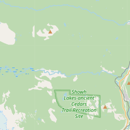
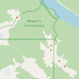


Waterfall height
Plan your visit to Nairn Falls
Please verify on the official website before you go
Why is Nairn Falls famous?
Nairn Falls is known for its dramatic 60-metre drop where the Green River plunges through a narrow granite gorge, creating powerful white water. The falls are a key feature of BC's Sea-to-Sky corridor and have been an important salmon run for millennia.
Can you swim at Nairn Falls?
No. The base of the falls is dangerous with strong currents and deep, cold water. Please verify on the official website before you go.
Are dogs allowed at Nairn Falls?
Dogs allowed on-leash on the trail. Please verify on the official website before you go.
Is Nairn Falls free? Do you need a permit?
Free. No entry fee or permit required for day use at Nairn Falls Provincial Park. Please verify on the official website before you go.
Is there parking at Nairn Falls?
Free parking available at the day-use area with approximately 40 spaces. The trailhead is directly from the parking lot. Please verify on the official website before you go.
How long is the hike to Nairn Falls?
About 3 km / 1.9 mi return from the parking area to the main viewpoint. Please verify on the official website before you go.
Nairn Falls hike difficulty
Easy. Mostly flat, well-maintained forest trail with minimal elevation gain and boardwalks in places. Please verify on the official website before you go.
When is the best time to visit Nairn Falls?
Late spring to early summer (May–July) for peak snowmelt flow when the falls are most impressive. Fall (September–October) offers fewer crowds and autumn colors. Please verify on the official website before you go.
Route and trail notes for Nairn Falls
From the parking area, follow the well-marked trail through old-growth forest along the Green River. The trail is mostly flat with some gentle ups and downs. You'll reach a viewing platform overlooking the falls at about 1.5 km. For a longer walk, continue on the trail which loops back through the forest.
Nairn Falls official website
Attractions near Nairn Falls
- •Pemberton - charming mountain town 5 km south with shops, restaurants, and farm tours
- •Joffre Lakes Provincial Park - stunning turquoise alpine lakes 35 km north
- •Green Lake - swimming and paddling spot 3 km south on Highway 99
- •One Mile Lake - easy walking loop with swimming and picnic areas in Pemberton
- •Whistler - world-class resort town 30 km south with year-round activities
Safety information
Waterfalls can be unforgiving. Read these before you go — and please, use your judgement on the day.
Full safety guide →Questions & answers
No questions yet — be the first to ask.
More to explore nearby
Shannon Falls
Squamish, British Columbia
BC's third-tallest waterfall on the Sea-to-Sky Highway.
Helmcken Falls
Wells Gray Park, British Columbia
Canada's fourth-tallest waterfall, freezes into an ice cone in winter.
Takakkaw Falls
Yoho National Park, British Columbia
Canada's second-tallest waterfall.
Wapta Falls
Yoho National Park, British Columbia
Widest waterfall on the Kicking Horse River.