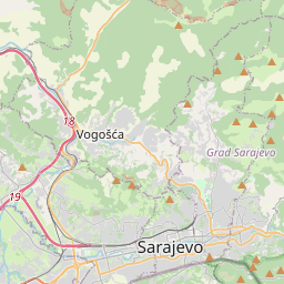
Skakavac Waterfall The last time I stood here, the waterfall wasn't moving. It had frozen solid, the whole rock face sealed under ice, white on white. That was winter. Six hundred-odd days have gone by since then, somehow, and this time the hillside around it is still green, just starting to edge toward the yellow of late autumn. Same waterfall, same spot on the trail, and it looked like a different place entirely. Standing there again, mist coming off the water and landing on my face, it was hard not to think about how much time had actually passed while I wasn't paying attention. Getting There Skakavac sits about 12 kilometres northeast of Sarajevo, above a village called Nahorevo, and at 98 metres it's one of the tallest waterfalls in the Balkans, even though the flow itself isn't huge. It was made a protected natural monument back in 2002. From the city, take bus (or minibus) route 69 from Sutjeska station and ride it to the last stop. From there, follow the signs toward the waterfall, about 4 kilometres of walking to reach the park entrance, and then another hour or so of trail beyond that to actually get to the falls. If you walk the whole stretch from the bus's last stop rather than catching a ride partway, the road passes a lot of local houses, with sheep grazing along the fields on either side. It's an easy, pleasant walk with decent scenery the whole way, not a hardship at all, just longer than the alternative. If you'd rather skip some of that road walking, you can arrange a lift to the actual trailhead and start hiking from there instead. From that point, the round trip to the waterfall and back runs about three hours. Once you reach the falls, you've got two ways back: retrace your steps the way you came, or cross over near the waterfall and loop around to rejoin the trail near the entrance. Either way gets you back to the road, where you can wait for the bus back into the city or arrange a ride. Worth Knowing Before You Go The waterfall freezes into different shapes each winter, which is part of why locals keep coming back to it season after season, it genuinely looks like a different place depending on when you visit. Summer and early autumn show it at its greenest, with the surrounding forest doing most of the work, since the flow itself is on the modest side compared to its height. If you're using a map app, searching "Skakavac Waterfall" gets you close enough to plan a route, whether that's the full walk from Nahorevo, a shorter hike from the trailhead, or something in between depending on how much walking you're up for that day.
Skakavac Falls


Waterfall height
Plan your visit to Skakavac Falls
Please verify on the official website before you go
Why is Skakavac Falls famous?
Skakavac is Bosnia and Herzegovina's highest waterfall and a beloved natural landmark near Sarajevo. The 98-meter cascade plunges through a narrow forested gorge in the Perućica primeval forest, making it a popular day hike for locals and a symbol of the region's natural beauty.
Can you swim at Skakavac Falls?
No. The waterfall is a tall cascade in a forested gorge; the base is not a swimming area. Please verify on the official website before you go.
Are dogs allowed at Skakavac Falls?
Dogs on leash are generally allowed on the hiking trail. Please verify on the official website before you go.
Is Skakavac Falls free? Do you need a permit?
Free — no entry fee or permit required to hike to the waterfall. Please verify on the official website before you go.
Is there parking at Skakavac Falls?
There is a small parking area near the trailhead at the end of the access road from Nahorevo village. Parking is typically free but space is limited. Please verify on the official website before you go.
How long is the hike to Skakavac Falls?
About 12 km / 7.5 mi return from Nahorevo village, or shorter if you drive partway on forest roads (conditions vary). Please verify on the official website before you go.
Skakavac Falls hike difficulty
Moderate. The trail involves a steady uphill walk through forest on uneven terrain with some elevation gain, but no technical sections. Please verify on the official website before you go.
When is the best time to visit Skakavac Falls?
Late spring and early summer (May–June) for highest water flow from snowmelt, or autumn (September–October) for pleasant hiking weather and fewer crowds. Please verify on the official website before you go.
Attractions near Skakavac Falls
- •Vrelo Bosne — scenic park at the source of the Bosna River with horse-drawn carriages
- •Bijambare Caves — cave system with stalactites and underground lakes northeast of Sarajevo
- •Baščaršija — Sarajevo's old bazaar and historic Ottoman quarter in the city center
- •Trebević Mountain — cable car access, hiking trails, and viewpoints overlooking Sarajevo
Safety information
Waterfalls can be unforgiving. Read these before you go — and please, use your judgement on the day.
Full safety guide →Questions & answers
No questions yet — be the first to ask.