Cataract Falls, Marin County — What to Know Before You Go Finally made it out to Cataract Falls! Just search "Cataract Falls" in your GPS and go — it's a little over an hour's drive from the Bay Area. One thing to watch out for: parking. It's free, but there are only around 20 spots, and I ended up too close to the road — got my first parking ticket of 2026 for it. Learn from my mistake and park properly clear of the roadway. The Trail The trail starts up a set of stairs, and you don't have to go far before you're already passing little waterfalls one after another. The whole way, it's the classic "small bridge, flowing water" spring scene — genuinely one of those walks where work and everything else just melts away for a bit. If the weather's good, this is exactly the kind of day to get out and walk it. We went counterclockwise, which front-loads most of the climbing in the first half. Along the way there are several falls, and you're basically walking with the sound of water the entire time — the air is damp and fresh, like walking through a natural oxygen bar. On the weekend, we did Cataract Falls via Rock Spring Trailhead, the full 5.6-mile route. Part of it follows the creek downhill for a bit over 3 miles until it flows into Alpine Lake — it's a little rough on the knees by the end, but the creek forms all kinds of little waterfalls along the way that make it worth it. Good for Dogs The trail is shaded the entire way and very dog-friendly. Ours got to cool off in the creek whenever they got tired, which they clearly loved. The View on the Way Out Coming back out of the hills, you get a view of the San Francisco skyline with the Golden Gate Bridge peeking out from under a layer of clouds — genuinely a stunning way to end the hike. Quick Tips Navigate straight to "Cataract Falls" — no need to overthink the destination. Parking is free but limited (~20 spots) — don't park too close to the road, or you might end up with a ticket like I did. Going counterclockwise front-loads the climbing early on. Trail is shaded the whole way and dog-friendly, with plenty of creek access for them to cool off. We did the Rock Spring Trailhead route, 5.6 miles round trip — plan for a few hours if you're taking your time. Spring is a great time for this one — full creek flow and everything green.
Cataract Falls
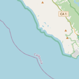
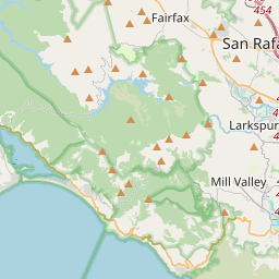
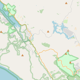
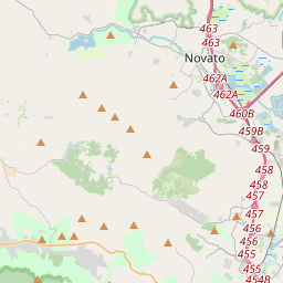


Waterfall height
Plan your visit to Cataract Falls
Please verify on the official website before you go
Why is Cataract Falls famous?
Cataract Falls is beloved for its series of dramatic winter cascades along Cataract Creek on Mount Tamalpais, forming one of the Bay Area's most impressive seasonal waterfall displays. The falls are a highlight of the historic Cataract Trail, cherished by local hikers for over a century.
Can you swim at Cataract Falls?
No — swimming is not permitted at Cataract Falls due to safety concerns and park regulations. Please verify on the official website before you go.
Are dogs allowed at Cataract Falls?
Dogs allowed on-leash on Cataract Trail and surrounding trails in Mount Tamalpais State Park. Please verify on the official website before you go.
Is Cataract Falls free? Do you need a permit?
Free — no entrance fee for Mount Tamalpais State Park day use at this trailhead, though parking is limited. Please verify on the official website before you go.
Is there parking at Cataract Falls?
Parking is available at the Laurel Dell Trailhead off of Bolinas-Fairfax Road (free, limited spaces). The trailhead provides access to Cataract Trail. Please verify on the official website before you go.
How long is the hike to Cataract Falls?
About 4.8 km / 3 miles return from Laurel Dell Trailhead via Cataract Trail, passing multiple cascades along Cataract Creek. Please verify on the official website before you go.
Cataract Falls hike difficulty
Moderate — the Cataract Trail descends through forest with some rocky, uneven sections and stream crossings; can be slippery when wet. Please verify on the official website before you go.
When is the best time to visit Cataract Falls?
Winter and early spring (December–April) for peak flow after winter rains; the falls can be dry by late summer. Please verify on the official website before you go.
Route and trail notes for Cataract Falls
From Laurel Dell Trailhead on Bolinas-Fairfax Road, follow the Cataract Trail downhill along Cataract Creek. The trail passes a series of cascades over approximately 1.5 miles; the main falls are partway down. The trail can continue down to Alpine Lake if desired. Return is uphill on the same trail.
Cataract Falls official website
Attractions near Cataract Falls
- •Alpine Lake — scenic reservoir with trail access, popular for hiking and picnicking
- •Bon Tempe Lake — nearby lake with loop trail, fishing, and peaceful forest setting
- •Mountain Theater — natural stone amphitheater on Mount Tamalpais with panoramic views
- •Steep Ravine Trail — dramatic redwood canyon trail connecting to coastal access
- •Pantoll Station — ranger station and trailhead hub with camping and trail information
Safety information
Waterfalls can be unforgiving. Read these before you go — and please, use your judgement on the day.
Full safety guide →Questions & answers
No questions yet — be the first to ask.
More to explore nearby
Bridalveil Fall
Yosemite Valley, California
First waterfall many visitors see in Yosemite.
Cedar Creek Falls (CA)
San Diego, California
Desert oasis waterfall east of San Diego.
Yosemite Falls
Yosemite Valley, California
North America's tallest measured waterfall.
Burney Falls
Burney, California
Spring-fed waterfall called 'the eighth wonder' by Teddy Roosevelt.